Tillamook Birder
  • Home
  • Where to Bird
    • Outer Coast
    • Tillamook Bay
    • Estuaries, Lowlands, Other Bays
    • Coast Range
  • Calendar
    • Jan - Feb
    • Mar - Apr
    • May - Jun
    • Jul - Aug
    • Sep - Oct
    • Nov - Dec
  • Sightings
    • Recent
    • Statewide
  • Resources
    • Tillamook CBC
    • Conditions
    • Lists
    • Publications >
      • Reed Ferris' 1930-1943 bird banding records and bird observations for Tillamook County, Oregon
      • Habitat Conservation Plan for the Western Snowy Plover
      • Cascade Head Scenic Research Area Management Plan
      • Nestucca Bay NWR Final Comprehensive Conservation Plan (CCP)
      • Tillamook Estuaries Partnership’s Tillamook Bay Comprehensive Conservation and Management Plan (CCMP) >
        • 2012 Fall NAMC
      • Species of Concern of the Tillamook Rainforest
      • 2011 Birding and Blues (David Irons) >
        • Tillamook County "Big Day", Feb 2012
      • Tillamook Bay Watershed Health Report 2010
    • Tillamook County >
      • Tillamook (John Rakestraw, 2012)
    • Topo Maps
  • Photo Gallery
    • MAK Gallery >
      • MAK Photos from Elsewhere
    • JE Gallery
    • KC Gallery
    • dv Gallery
    • b-j Gallery
    • JB Gallery
    • Other Photos
  • Links
  • TillamookBirderBlog
  • Contact

Birding Locations - Estuaries, Lowlands and other Bays

We are working on adding additional Birding Sites to our website.  In the meantime, do you have a favorite birding spot or birding tips for specific spots in Tillamook County? Please tell us about it, we'd love to include it!
​​Check local specific information regarding any closures or special restrictions.

Nehalem Meadows, Water Treatment Plant
ADVISORY: Be courteous and obey the signs at the WTP to ensure continued access for other birders.
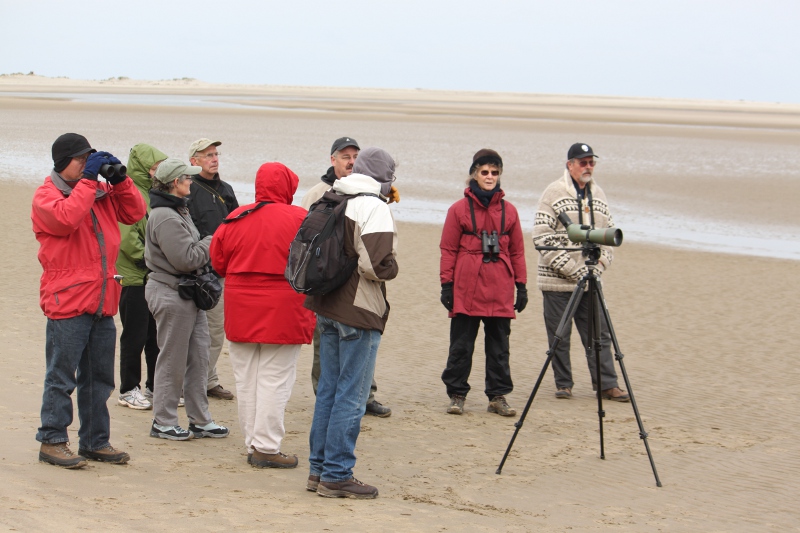
Located east of Nehalem off of Tideland Road, the meadows and sewage ponds offer a large area for birding.  Tideland loops around the meadows to OR 53 back to 101.
  • At high tide, look for shorebirds at the Water Treatment Plant (WTP), sightings include Stilt and Semipalmated Sandpipers
  • Spring/summer look for Bank Swallows, Western Kingbirds, Western Meadowlarks
  • White-tailed Kites frequently seen (except summer), winter raptors include occasional Gyrfalcons
  • If you complete the loop, dairy farms and small ponds in and around Mohler often yield rarities

Bird Observations (eBird)
eBird "Hotspot Explorer" for the meadows
eBird "Hotspot Explorer" (WTP)

Additional information
  • Nehalem Water Treatment Plant
  • Oregon Coast Birding Trail Guide (#27) [pdf]
Picture
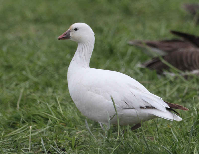
Ross's Goose -- Photo: Jack Booth
Conditions (also see our "Conditions" page)
  • Weather
  • Tidal predictions (Nehalem)
Alder Creek Farm, Nehalem
ADVISORY: Unimproved trails, boots required much of the year.
Located in Nehalem at the end of Underhill Lane, the 50 acre former dairy farm, part of the Nehalem estuary, is being restored to fresh and salt water marsh with vegetated uplands.
  • This under-birded area in offers opportunities for wetlands-area species, including migrating shorebirds (fall/spring)
  • Hike the trail that runs along Alder Creek to Nehalem Bay

Bird Observations (eBird)
eBird "Hotspot Explorer"

Additional information
  • Alder Creek Farm​
  • On Safari with Mike Patterson - Sparrow City
  • Oregon Coast Birding Trail Guide (#26) [pdf]
Picture
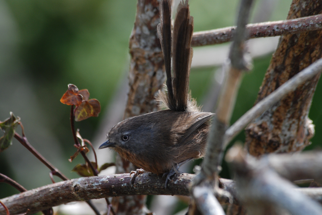
Wrentit -- Photo: Ken Chamberlain
Conditions (also see our "Conditions" page)
  • Weather
  • Tidal predictions (Nehalem)
Whiskey Creek Fish Hatchery, Netarts Bay
Located on Whiskey Creek/Netarts Bay Road, the small hatchery is worth a stop. Short trails wind through park-like woodlands to the bay. Bald Eagles and Osprey frequent the area. Park in the large, gravel lot or in the hatchery itself. 
  • In winter offers great views of birds on the bay
  • Spring and fall, small migrants can be viewed from the trails

Bird Observations (eBird)
eBird "Hotspot Explorer" for the Fish Hatchery

Additional information
  • Whiskey Creek Fish Hatchery
Picture
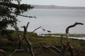
Netarts Bay (Hatchery view) -- Photo: dawn villaescusa
Conditions (also see our "Conditions" page)
  • Weather
  • Tidal predictions (Netarts)
Nestucca Bay National Wildlife Refuge (NWR)
The Nestucca Bay NWR is located south of Nestucca Bay off Highway 101 (turn west on Christensen Rd). The lower parking lot offers views of the Nestucca River Valley, a winter staging area for thousands of Canada and Cackling Geese.  No fee.
  • One of the only places in Oregon where all subspecies of Canada and Cackling Geese can be seen (winter, early spring)
  • Walk to the upper parking lot during spring/fall migrations, watch for migrants along the gravel road
  • Cannery Hill (upper viewing area) offers panoramic views where Bald Eagles, Peregrine Falcons and other raptors are often seen

Bird Observations (eBird)
eBird "Hotspot Explorer" for Nestucca Bay NWR
Also see Nestucca Bay "Hot Spot"

Additional information
  • Nestucca Bay NWR
  • Trail map [pdf]
  • NBNWR 2011 Blog
Picture
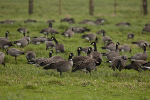
Canada and Cackling Geese -- Photo: Roy Lowe
Conditions (also see our "Conditions" page)
  • Weather (Pacific City)
  • Tidal predictions (Nestucca Bay Entrance)
Clay Myers, Whalen Island
ADVISORY:  The county park is a fee area, but there is free parking further in at the SNA. 
Clay Myers State Natural Area (SNA) and Whalen Island County Park are located together off of Highway 101 midway between Cape Lookout and Cape Kiwanda on the Three Capes Scenic route.
  • Spring and fall, walk the loop through the wood for vagrant warblers and other passerines. Moderately easy trail, about 1.5 miles.
  • Meadows offer prime sparrow habitat, with Osprey (spring/summer) and Northern Harrier (fall/winter).
  • Take the west trail to the lake at mid-tide for migrating shorebirds and Brant in the fall. Scope recommended. 

Bird Observations (eBird)
eBird "Hotspot Explorer" for Clay Myers
eBird "Hotspot Explorer" for Whalen Island

Additional information
  • Clay Myers SNA at Whalen Island
  • County park information [pdf]
  • Nov 2011 Field Report
  • Oregon Coast Birding Trail Guide (#41) [pdf]
Picture
Clay Myers Tidal Flats (2011) -- Photo: dawn villaescusa
Conditions (also see our "Conditions" page)
  • Weather (Pacific City)
  • Tidal predictions (Netarts)
Neskowin
ADVISORY: Obey the signs and stay off the golf course. There is no public parking in the village so park at the wayside.
Located just south of the Nestucca Bay NWR, Neskowin consists of Neskowin village, Neskowin Marsh (part of the NBNWR), a small state park and a golf course that is flooded most of the year.
  • Park in the wayside, cross the bridge and walk the length of Hawk Street, then walk west and return on the beach
  • Winter flooded golf course excellent for migrating waterfowl and shorebirds
  • The NWR is closed to the public, but parts can be viewed from Hawk Street (north end) and a small Tsunami Evaculation path accessible from that street

Tillamook Birder Bird List for Neskowin
Bird Observations (eBird)
eBird "Hotspot Explorer" for Neskowin

Additional information
  • Neskowin Marsh Unit of the Nestucca Bay NWR
  • Neskowin Beach State Recreation Site
Picture
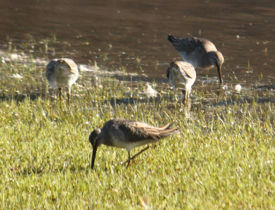
Dowitcher -- Photo: dawn villaescusa
Conditions (also see our "Conditions" page)
  • Weather
  • Tidal predictions (Nestucca Bay entrance)
All photographs are the property of stated photographer and may not be copied or used without the photographer's written consent.
Please report broken links.  Thank you!
Proudly powered by Weebly